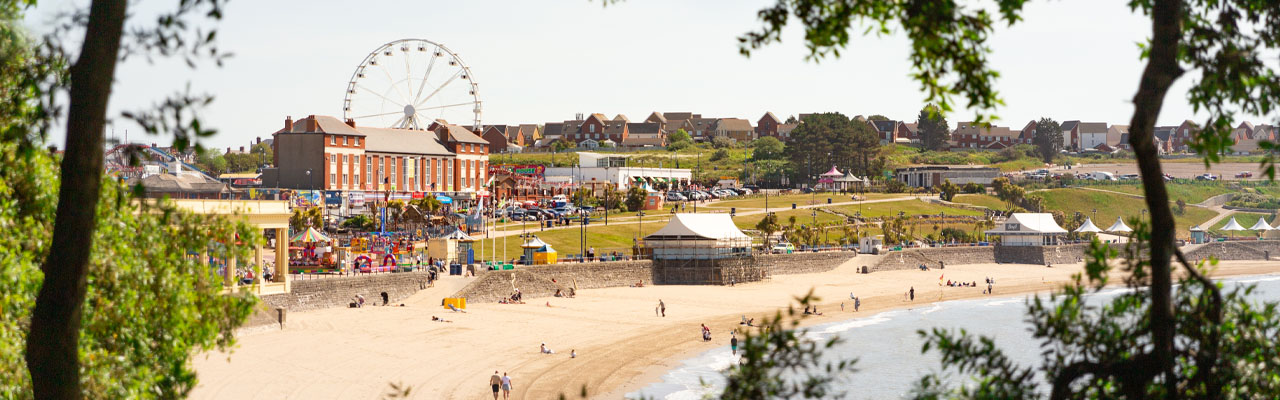
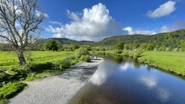
Explore Barry Island
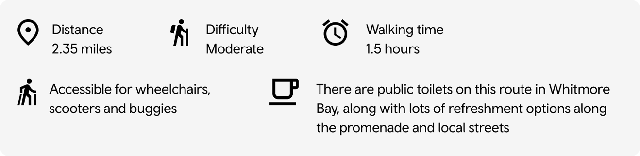
This route follows the Wales Coast Path around Nells Point, Whitmore Bay, and Friars Point. The route is
mostly flat apart from a steady climb at the start. The views of the coastline are worth it. After your walk
there are several good food options in Whitmore Bay. There’s an option to extend this walk.
Routes can be affected by path closures, blockages and diversions. If you find yourself unable to continue with your walk please try to find an alternate route or retrace your steps. Report any issues to your local authority. All information is correct at the time of publishing and is subject to change.
Barry Island Ramblers Cymru route
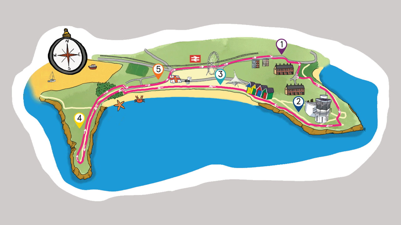
- As you leave the train station head left up Station Approach Rd, which then becomes Breaksea Drive. Be sure to cross the road at one of the dropped curb crossings if required as you climb. Our route turns right at the top of the rise at the T-junction onto Friars Road where there is no mobility provision. Follow the pavement around to the right and cross the road using the dropped curb crossing point. Continue to your right to reach a tarmac path on your left taking you down onto the coast path.
- Head right on the coast path taking in the fine views across the Severn Estuary with Jacksons Bay below you and Breakwater Lighthouse in view. Follow the path around the corner to reach Nells Point where there is a National Coastal Institution building. Be sure to take the steep path on your left just after the building leading down onto the bottom path. This is the only accessible path option that leads you around and down onto the promenade at Whitmore Bay. Follow this lower path as it leads you around Nells Point passing a WW2 Coast Artillery building. Follow the path as it slowly descends into Whitmore Bay and the wide promenade.
- There are public toilets at the start of the promenade along with a water refill station. Continue to follow the promenade as it wraps around Whitmore Bay leading to cafes. It is possible here to walk across the beach. Our mobility route follows the promenade to the far side and heads right to join the pavement just before the larger area of cafes and grand pillared building. On the pavement go left to walk behind the pillared building onto a path with trees either side. This path eventually opens up onto Friars Point. If you walked across the beach, you can join the same path at the far side by using the ramp off the beach.
- Follow the path all the way to the end of Friars Point for amazing views out across the Severn Estuary. Continue around to the right as the path wraps around and then retraces its path back towards the promenade. There is an option here to extend your route - As the path re-traces it steps take the tarmac path to the left opposite the ramp down to the beach. This path leads you around to Barry Harbour and a car park. Head across the car park to reach the road. Go right here and then left just after you pass under the railway bridge to head back to the Station. This section is also mobility friendly.
- Our route returns you to Whitmore Bay where there are plenty of café options. Once you’ve enjoyed the cafes and arcades on offer follow the pedestrianised area up away from the promenade to reach Station Approach Rd. Use the dropped curb crossing point and then head right to return back to the train station.
View route on Go Jauntly Download GPX
View and download the full PDF map More routes
Getting there
Our rail network extends the length and breadth of Wales, stopping off at multiple points so you can hop off and start or continue your adventure on foot. Our unlimited travel passes are a great way of exploring our network and include bus travel from selected providers.
Discover more on our network
There’s lots to see and do along our network, and you can access exclusive discounts with your TfW ticket.